
Description
SEE THE WORLD. STAY IN TOUCH. BE THE PICTURE OF ADVENTURE.
The rugged Montana 750i handheld combines the flexibility of on- or off-road navigation with global messaging and interactive SOS via inReach satellite technology1 — plus a built-in 8-megapixel camera.
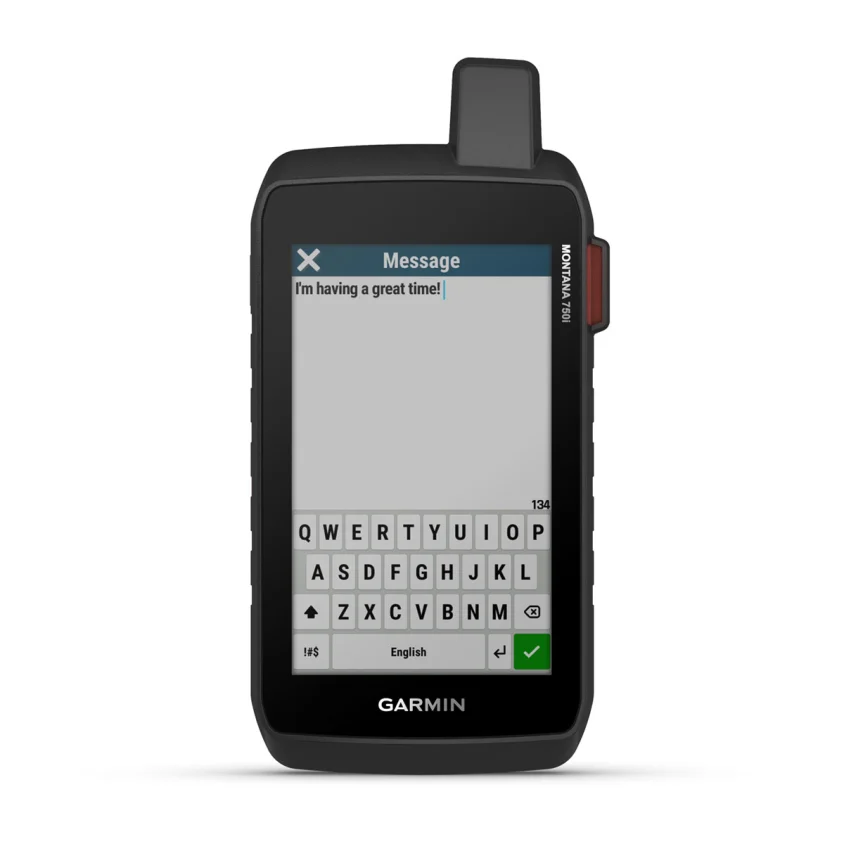
Big news. A full QWERTY keyboard lets you easily type messages.

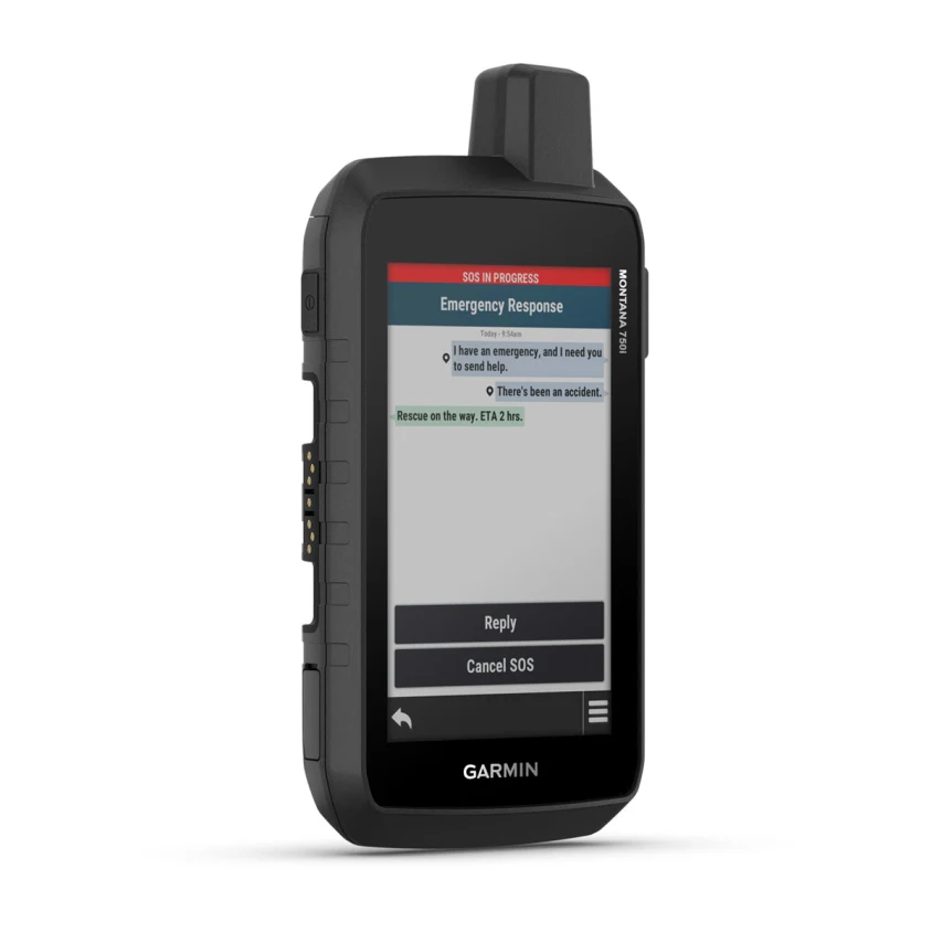
Wander wider and still stay in touch — with inReach for messaging and 24/7 SOS.

Nav, meet cam. Put your trip pics on the map with geotags.

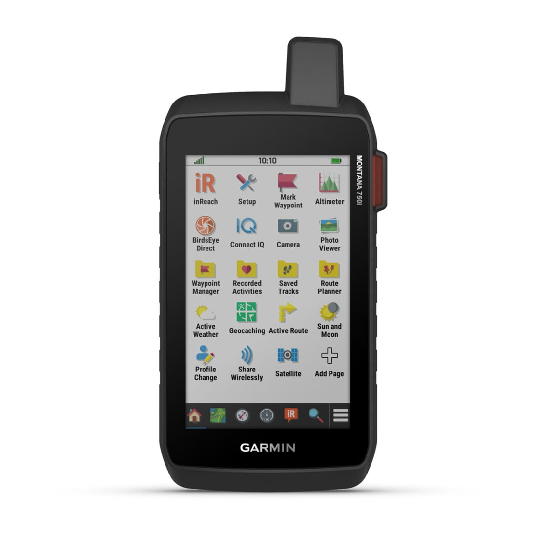
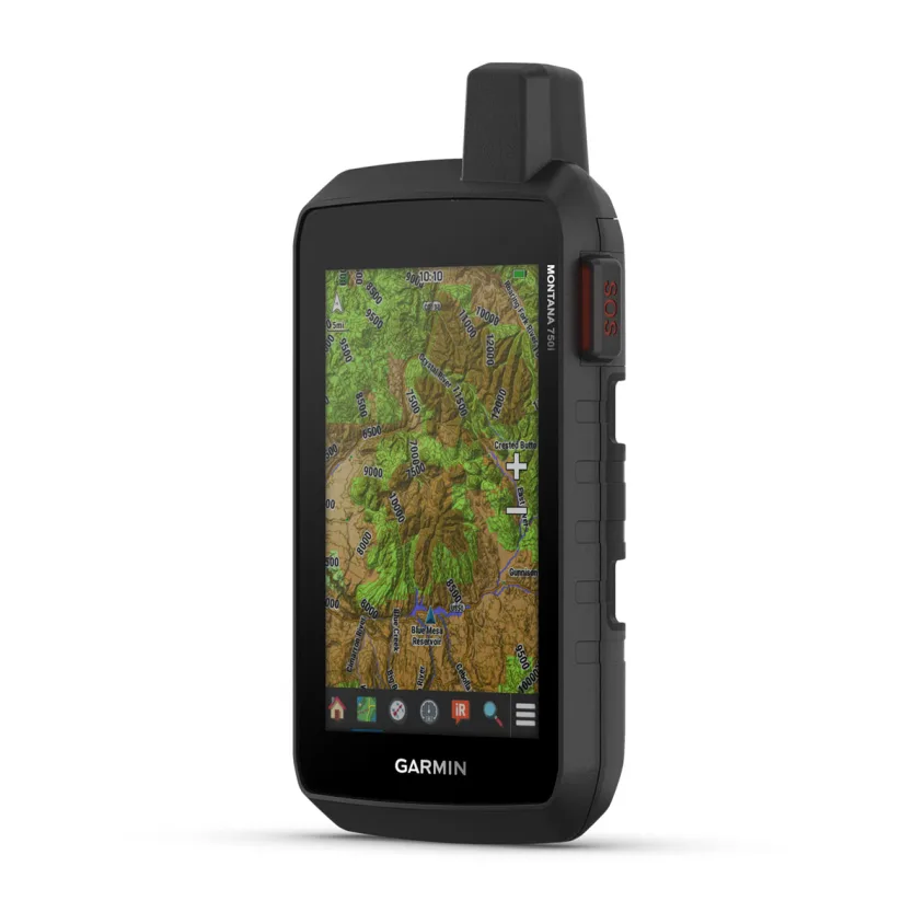
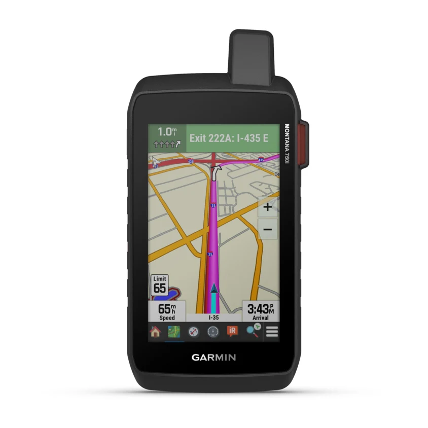
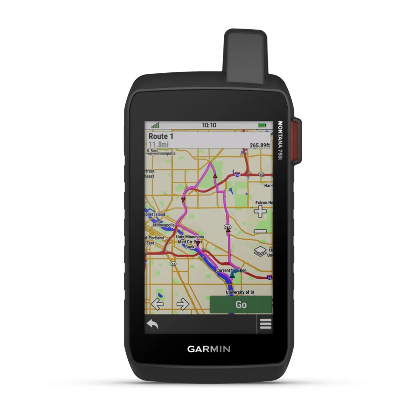
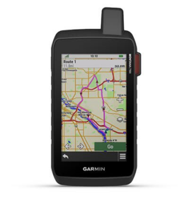
Routable topographic maps? Check. Now you’re free to take it off-road or on.

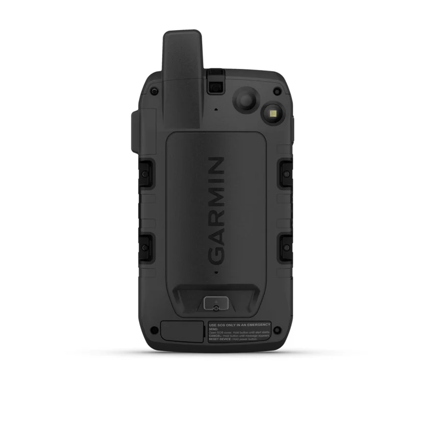
Built like a tank. Meets MIL-STD 810 for thermal, shock, water and vibration.
Power your adventures with 18+ hours of lithium-ion battery life in GPS mode.

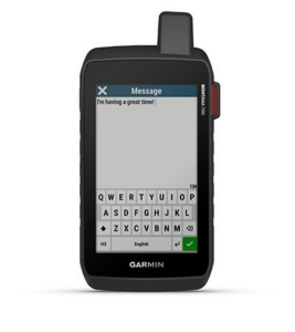
TWO-WAY MESSAGING
Exchange text messages with loved ones back home or communicate inReach to inReach in the field (active satellite subscription required).
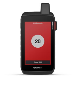
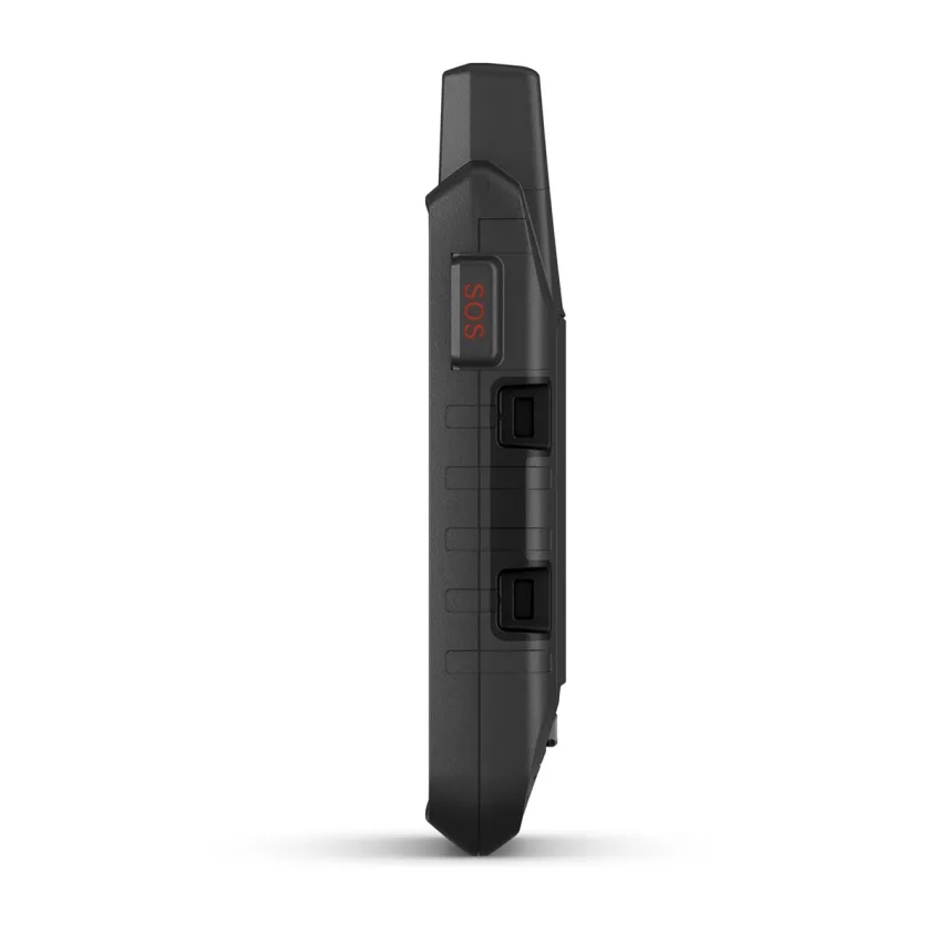
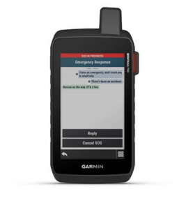
INTERACTIVE SOS
In case of emergency, trigger an interactive SOS message to Garmin ResponseSM, a 24/7 staffed professional emergency response coordination center (active satellite subscription required).
GLOBAL CONNECTIVITY
Instead of relying on cellphone coverage, now your messages, SOS and tracking are transferred via the 100% global Iridium® satellite network (active satellite subscription required).
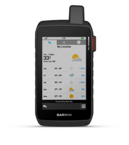
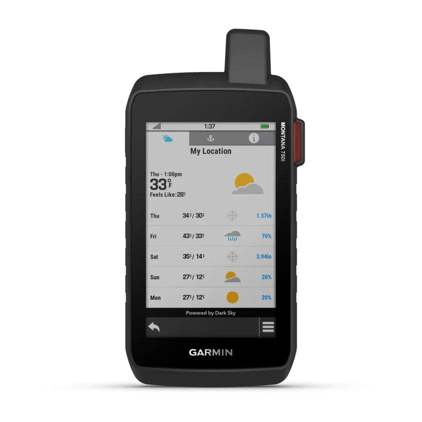
INREACH WEATHER
Available inReach weather forecast service provides detailed updates directly to your Montana handheld or paired devices, so you’ll know what to expect en route.

Outdoor Maps+
Add a subscription to Outdoor Maps+, and get ongoing access to a wide variety of premium mapping content and regular updates sent right to your Garmin device via Wi-Fi® technology.
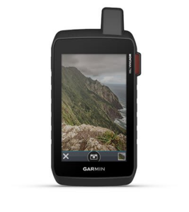
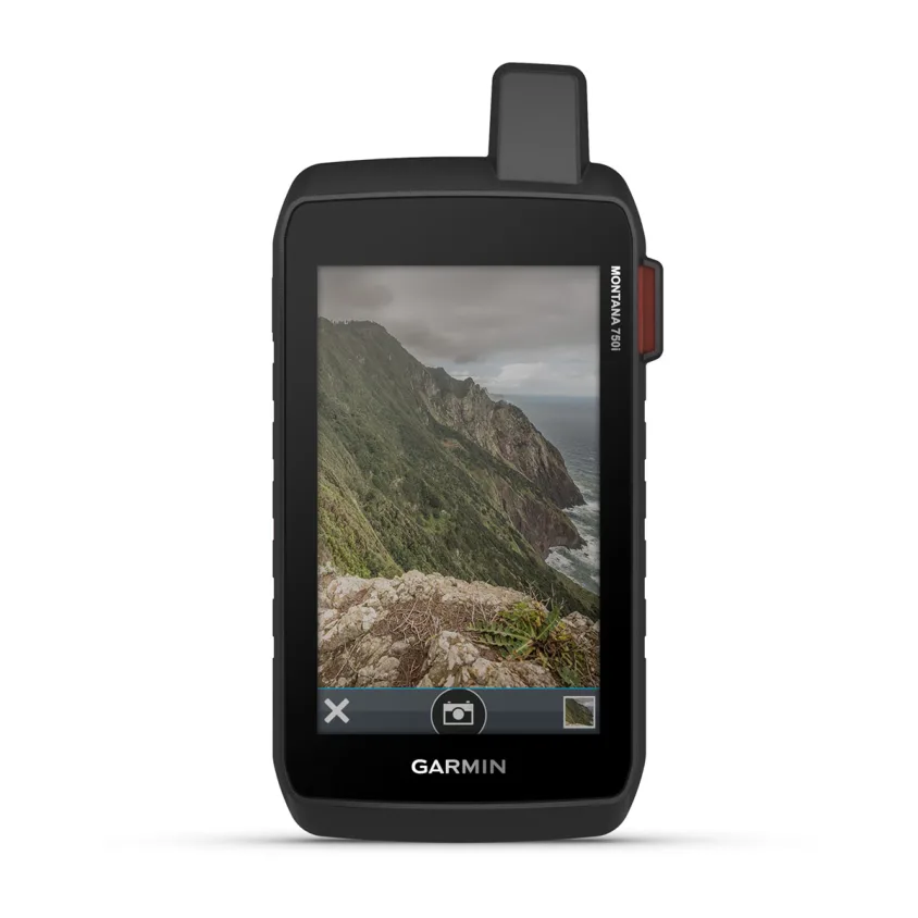
BUILT-IN CAMERA
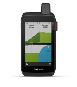
Capture images of your exploits with Montana’s digital 8-megapixel camera. It geotags photos with coordinates, so you can navigate back to favorite sites in the future.
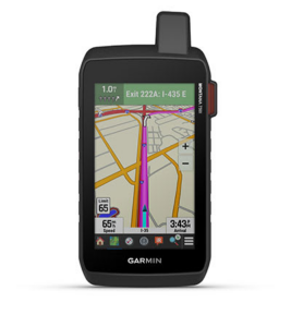
CITY NAVIGATOR® MAPS
Seamlessly transition from trails to road navigation with preloaded City Navigator street mapping, which guides your drive with easy-to-follow turn-by-turn directions.

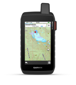
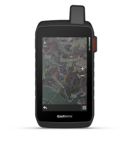
TOPOACTIVE MAPS
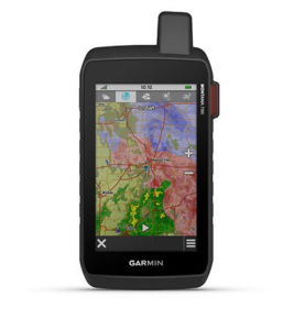
To navigate your adventures, use preloaded topographical maps for the U.S. and Canada. View terrain contours, elevations, coastlines, rivers, landmarks and more.
ADDITIONAL MAPS
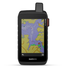
With 16 GB of onboard memory and a microSD™ card slot for expandable storage, you can download even more maps such as BlueChart® g3 for the water.
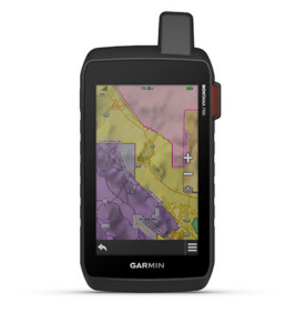
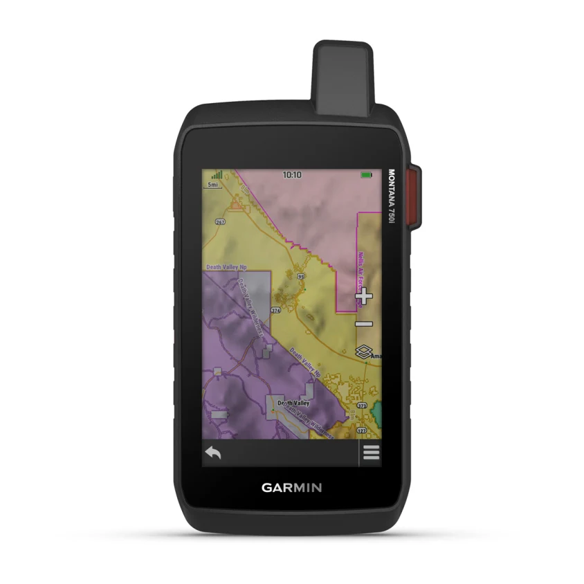
PUBLIC LAND BOUNDARIES
Optional display of federal public land boundaries on topographical maps helps you know that you’re venturing where you’re supposed to be.
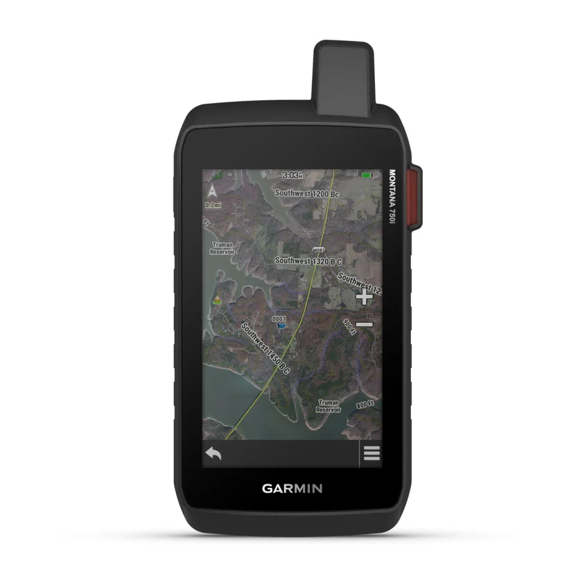
SATELLITE VIEWS
Use direct-to-device downloads of BirdsEye Satellite Imagery (no annual subscription required) to see photo-realistic views and create waypoints based on landmarks.
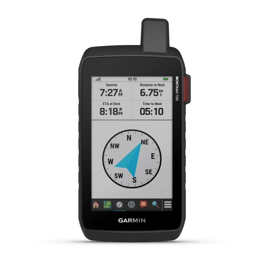
ABC SENSORS
Navigate your next trail with ABC sensors, including an altimeter for elevation data, barometer to monitor weather and 3-axis electronic compass.
ACTIVE WEATHER
Use cellular connectivity2 to access up-to-date Active Weather forecasts through the Garmin Connect™ app.
![]()
DOG TRACKING
For hunters and trainers, this Montana syncs with compatible Astro® or Alpha® series handhelds (sold separately) to help track sporting dogs in the field.
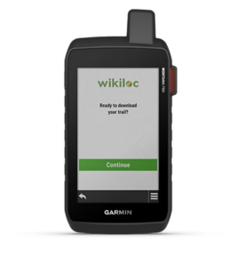
WIKILOC TRAILS
This preloaded app lets you easily download hiking, cycling and other Wikiloc trails shared by outdoor enthusiasts like you. Get a free 60-day Wikiloc Premium trial to try this and other exclusive features. Learn more.
RUGGED BY DESIGN
This durable, water-resistant handheld is tested to U.S. military standards and features a glove-friendly 5” touchscreen that’s 50% larger than previous Montana models.

MULTI-GNSS SUPPORT
Access to both GPS and Galileo satellite networks enables Montana 750i to track in more challenging environments than GPS alone.
TRACKING
Using your web-based MapShare™ trip-sharing page, followers can see your progress, ping your device to see your GPS location and exchange messages during your trip.
EXPEDITION MODE
Trek far and wide off-grid. Use Expedition mode, an ultralow-power GPS reference, to keep Montana tracking for a week or more between recharges.
EXTENDED BATTERY LIFE
An internal, rechargeable lithium-ion battery pack provides more than 18 hours of battery life in GPS mode.
VEHICLE MOUNTS
A variety of Montana handheld-compatible mounts (sold separately) lets you adapt your navigator for use on ATVs, boats, cars, motorcycles, RVs or other vehicles.
Reviews
There are no reviews yet.