
Description
CAST OFF CONFIDENTLY WITH A PREMIUM MARINE HANDHELD GPS
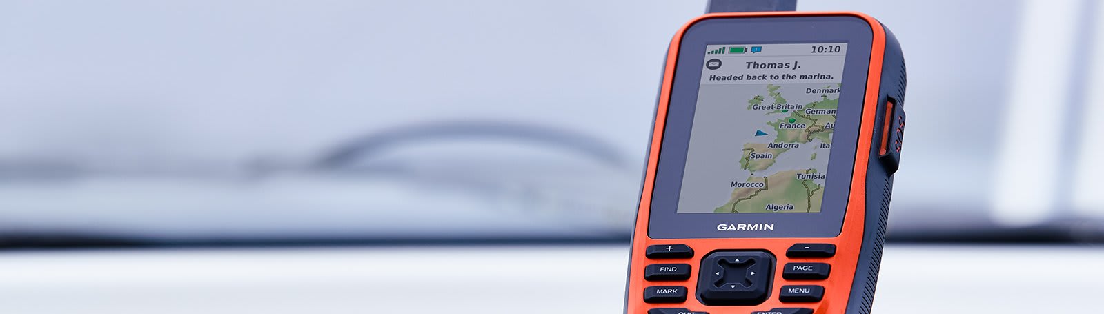
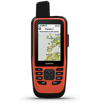
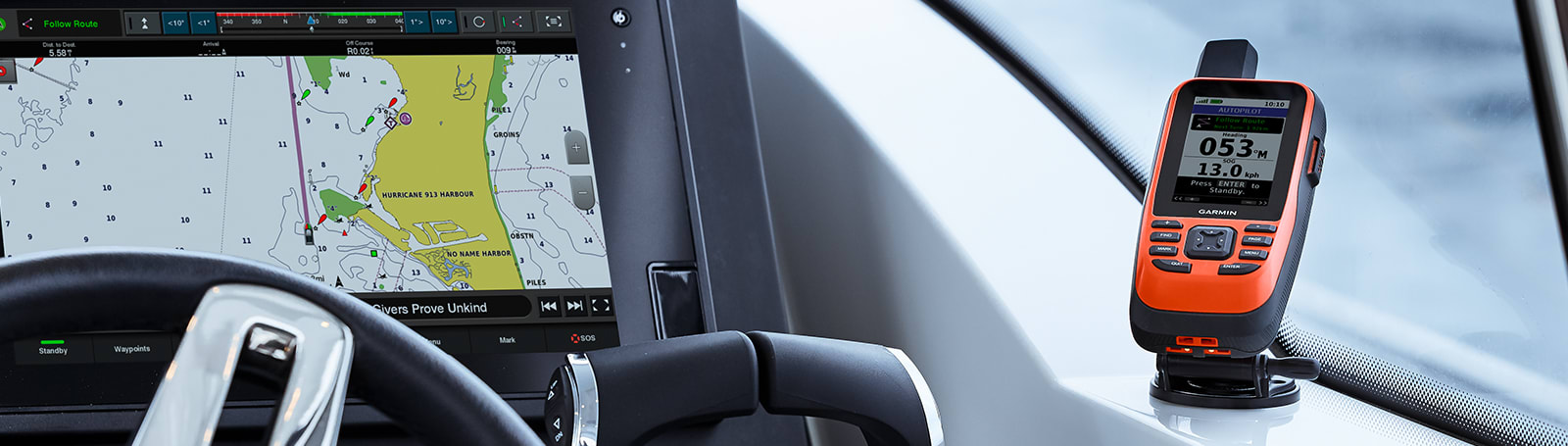
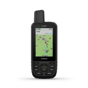
Stay on course with the GPSMAP 86i handheld. It provides all the outdoor functions and global communications of the GPSMAP® 66 series and adds on-the-water features — including wireless connectivity to your onboard marine system.
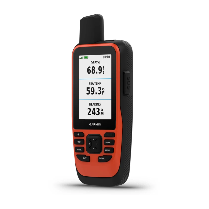
See all your marine system info at a glance with boat data streaming.
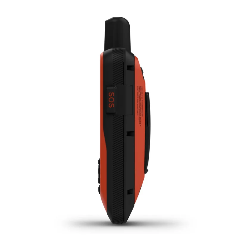
Cruise with peace of mind. inReach interactive SOS is there if you need it2.
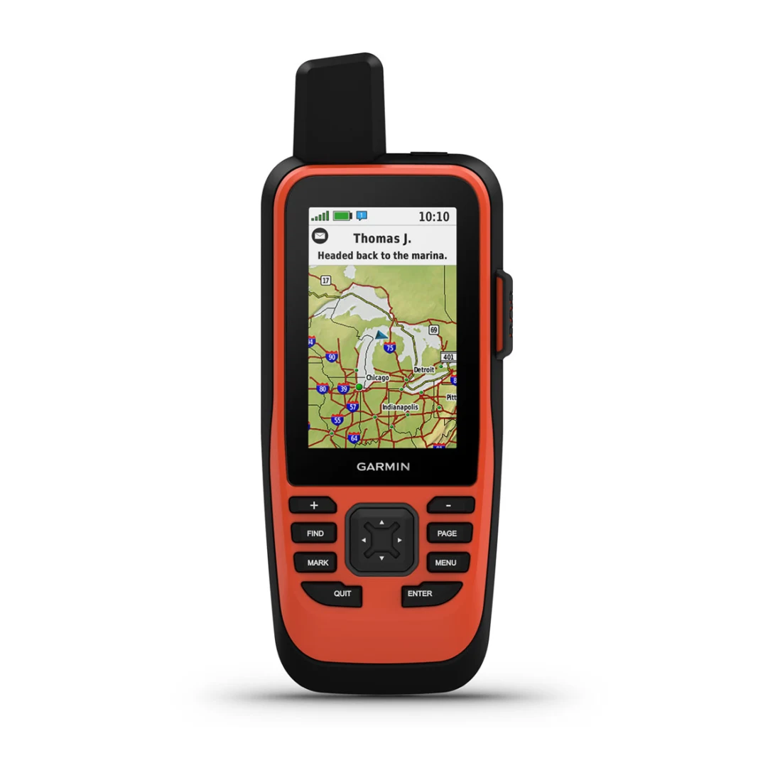
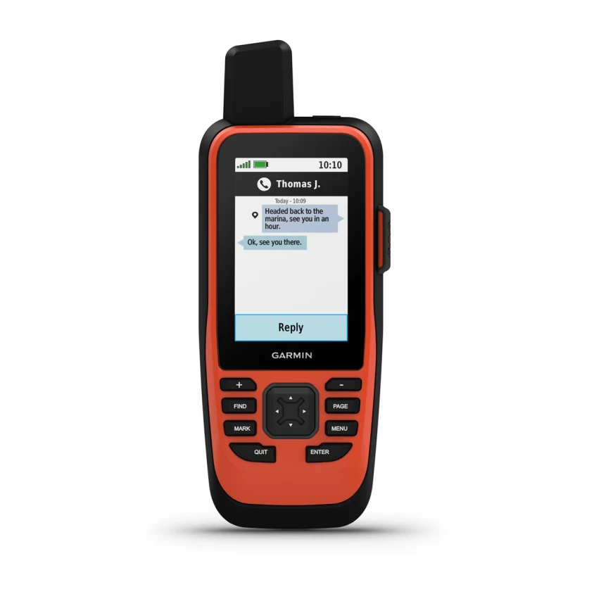
Send and receive text messages from anywhere2.
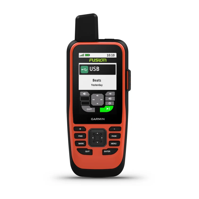
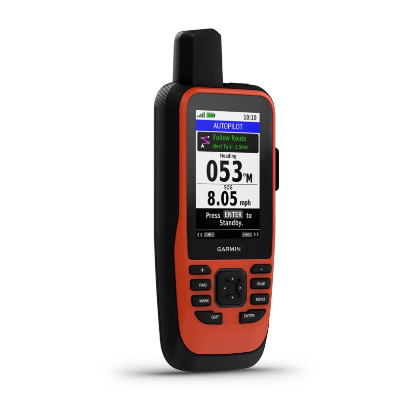
Put convenient control of your autopilot and Fusion® systems at your fingertips.
Stay out longer with up to 35 hours of battery life in 10-minute tracking mode.
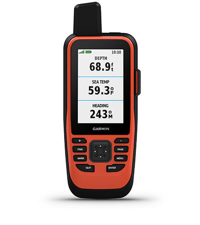
BOAT DATA
Sync with compatible Garmin chartplotters and instruments to see real-time boat data displayed right on your handheld.
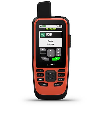
FUSION-LINK AUDIO
Get convenient remote operation of select onboard Fusion marine products.

ACCURATE TRACKING
When you’re underway, an adjustable GPS filter smooths speed and heading indications as you pass over swells for more accurate tracking.
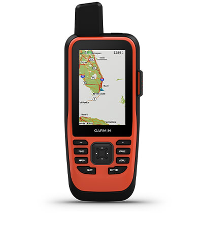
WORLDWIDE BASEMAP
See worldwide shaded relief coverage, including oceans, seas, major lakes and rivers. And see international and state political boundaries and time zone information.
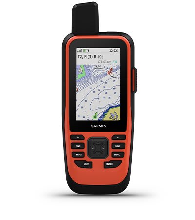
BLUECHART COVERAGE
Add optional BlueChart g3 coastal charts give you leading-edge coverage, clarity and detail with integrated Garmin and Navionics data.
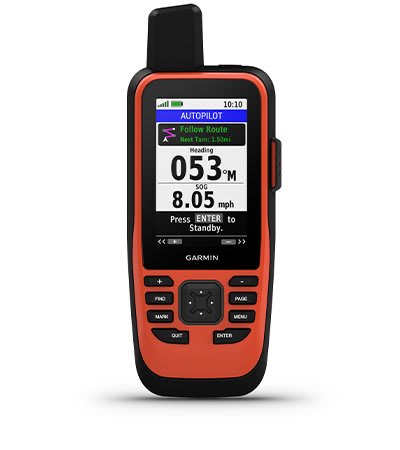
AUTOPILOT REMOTE
Even when you’re not at the helm, you can control your boat. Access the autopilot app to change heading, engage pattern steering and follow a GPS route.
BACKUP NAVIGATION
Whether you’re out for a day of fishing, sailing or cruising, gain peace of mind that comes from having a backup navigator.
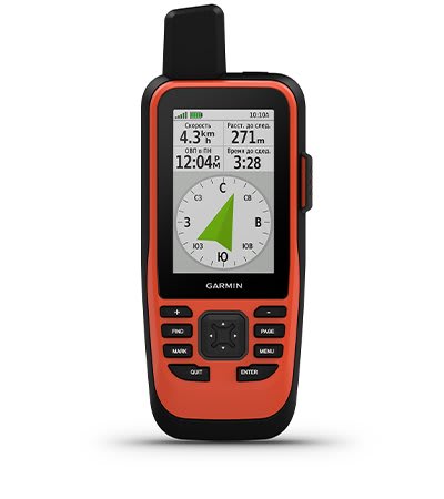
ABC SENSORS
Navigate anywhere with ABC sensors, including an altimeter for elevation data, barometer to monitor weather and 3-axis electronic compass.

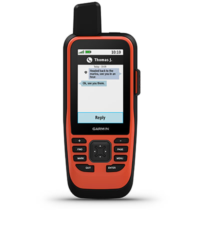
TWO-WAY MESSAGING
The Iridium® satellite network1 lets you send and receive custom and preset text messages or emails with a delivery confirmation2.
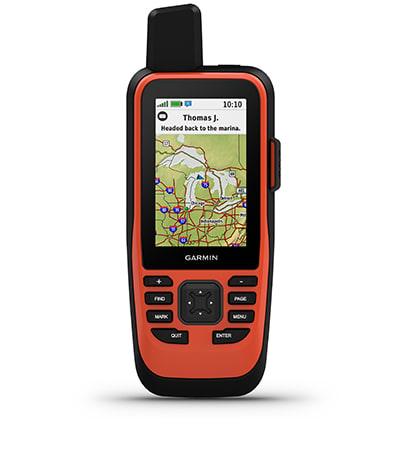
TRIP TRACKING
Share your adventures with your web-based MapShare™ trip-sharing page so loved ones can see your progress or ping your device to see your GPS location2.
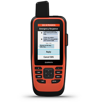
INTERACTIVE SOS
In case of emergency, trigger an interactive SOS message to the Garmin IERCC, a 24/7 staffed professional emergency response coordination center via the 100% global Iridium satellite network.
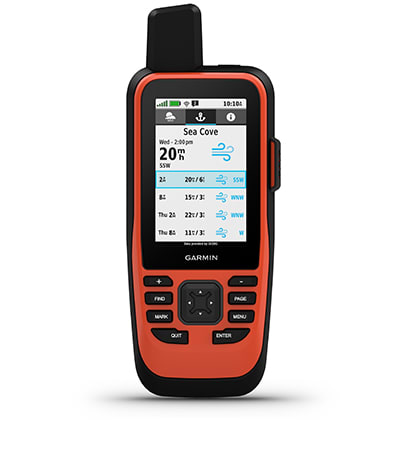
MARINE WEATHER
Receive weather forecasts directly on your device, so you can make educated decisions based on local conditions or the destination ahead2.
SMART NOTIFICATIONS
Get smart notifications right on your GPSMAP 86i handheld when you pair it with your compatible smartphone.
GARMIN EXPLORE™ APP
Sync GPSMAP 86i with Garmin Explore for cloud management of your favorite waypoints, tracks and routes.
WIRELESS CONNECTIONS
GPSMAP 86i offers Wi-Fi® connectivity, ANT+® technology and BLUETOOTH® wireless technology for easy wireless updates and connections. .
LED FLASHLIGHT
The GPSMAP 86i helps you keep gear to a minimum with a built-in LED flashlight that can be used as a beacon to signal for help.
BATTERY LIFE
The internal, rechargeable lithium battery provides up to 35 hours of operation in 10-minute tracking mode and up to 200 hours in expedition mode3.
Reviews
There are no reviews yet.