


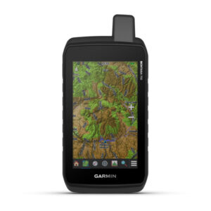
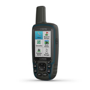
Montana® 750i
Rugged GPS Touchscreen Navigator with inReach® Technology and 8 Megapixel Camera
PART NUMBER 010-02347-00
Description
SEE THE WORLD. STAY IN TOUCH. BE THE PICTURE OF ADVENTURE.
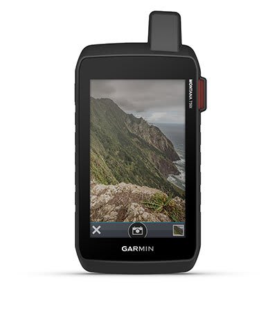
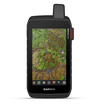
The rugged Montana 750i handheld combines the flexibility of on- or off-road navigation with global messaging and interactive SOS via inReach satellite technology1 — plus a built-in 8-megapixel camera.

|
|
|
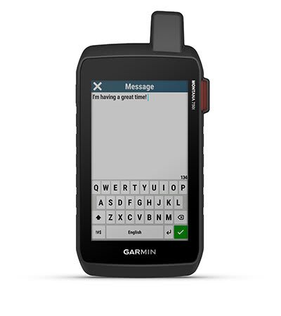 TWO-WAY MESSAGING
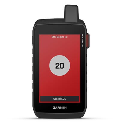
|
|

|
|
|
|
|
|
|
|
|
|
|
|
|
|
|
|

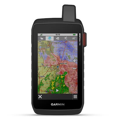
MULTI-GNSS SUPPORTAccess to both GPS and Galileo satellite networks enables Montana 750i to track in more challenging environments than GPS alone. |
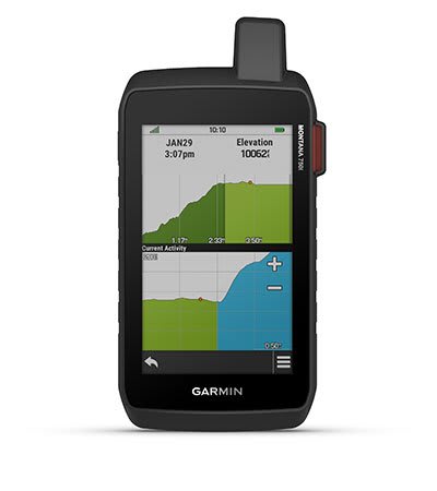
TRACKINGUsing your web-based MapShare™ trip-sharing page, followers can see your progress, ping your device to see your GPS location and exchange messages during your trip. . |
EXPEDITION MODETrek far and wide off-grid. Use Expedition mode, an ultralow-power GPS reference, to keep Montana tracking for a week or more between recharges. |
EXTENDED BATTERY LIFEAn internal, rechargeable lithium-ion battery pack provides more than 18 hours of battery life in GPS mode. |
VEHICLE MOUNTSA variety of Montana handheld-compatible mounts (sold separately) lets you adapt your navigator for use on ATVs, boats, cars, motorcycles, RVs or other vehicles. |
SPECIFICATION
Specifications:
| General | |
| DIMENSION | 3.4″ x 7.2″ x 1.3″ (8.76 x 18.30 x 3.27 cm) |
| TOUCHSCREEN | Yes |
| DISPLAY SIZE | 2.55″W x 4.25″H (6.48 x 10.80 cm); 5″ diag (12.70 cm) |
| DISPLAY RESOLUTION | 480 x 800 pixels |
| DISPLAY TYPE | WVGA transflective, dual orientation |
| WEIGHT | 14.0 oz (410 g) with included lithium-ion battery pack |
| WATERPROOF | IPX7 |
| BATTERY TYPE | rechargeable lithium-ion (included) |
| BATTERY LIFE | GPS Mode: up to 18 hours GPS Mode, 10 min Tracking: up to 18 hours Expedition Mode: up to 330 hours Expedition Mode, 30 min Tracking: up to 300 hours |
| MIL-STD-810 | yes (thermal, shock, water, vibe) |
| INTERFACE | high speed micro USB and NMEA 0183 compatible |
| MEMORY/HISTORY | 16 GB (user space varies based on included mapping) |
| Maps & Memory | |
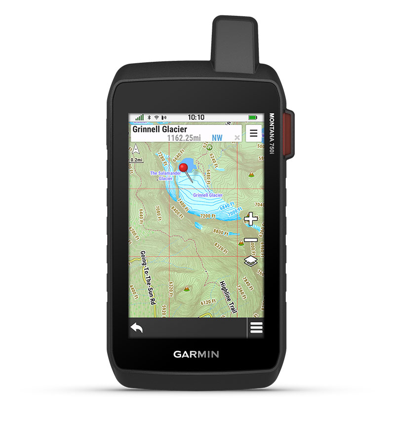
| PRELOADED MAPS | yes (TopoActive, by region; Federal Public Lands maps, U.S. only) |
| ABILITY TO ADD MAPS | Yes |
| BASEMAP | Yes |
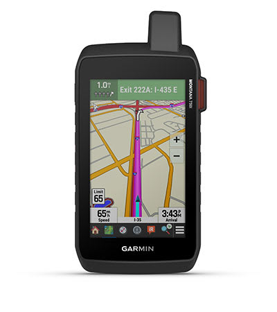
| AUTOMATIC ROUTING (TURN BY TURN ROUTING ON ROADS) FOR OUTDOOR ACTIVITIES | Yes |
| AUTOMATIC ROUTING (TURN BY TURN ROUTING ON ROADS) FOR MOTORIZED VEHICLES | Yes |
| MAP SEGMENTS | 15000 |
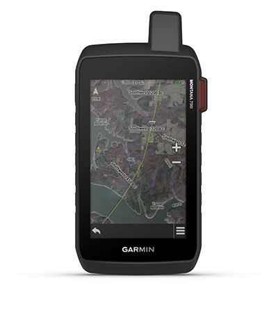
| SATELLITE IMAGERY | yes (direct to device) |
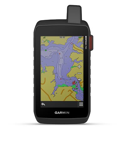
| INCLUDES DETAILED HYDROGRAPHIC FEATURES (COASTLINES, LAKE/RIVER SHORELINES, WETLANDS AND PERENNIAL AND SEASONAL STREAMS) | Yes |
| INCLUDES SEARCHABLE POINTS OF INTERESTS (PARKS, CAMPGROUNDS, SCENIC LOOKOUTS AND PICNIC SITES) | Yes |
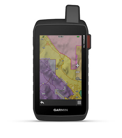
| DISPLAYS NATIONAL, STATE AND LOCAL PARKS, FORESTS, AND WILDERNESS AREAS | Yes |
| EXTERNAL MEMORY STORAGE | yes (32 GB max microSD™ card) |
| WAYPOINTS/FAVORITES/LOCATIONS | 10000 |
| TRACKS | 250 |
| NAVIGATION TRACK LOG | 20000 points, 250 saved gpx tracks, 300 saved fit activities |
| NAVIGATION ROUTES | 250, 250 points per route; 50 points auto routing |
| RINEX LOGGING | Yes |
| Sensors | |
| HIGH-SENSITIVITY RECEIVER | Yes |
| GPS | Yes |
| GALILEO | Yes |
| BAROMETRIC ALTIMETER | Yes |
| COMPASS | Yes (tilt-compensated 3-axis) |
| GPS COMPASS (WHILE MOVING) | Yes |
| Daily Smart Features | |
| CONNECT IQ™ (DOWNLOADABLE WATCH FACES, DATA FIELDS, WIDGETS AND APPS) | Yes |
| SMART NOTIFICATIONS ON HANDHELD | Yes |
| VIRB® REMOTE | Yes |
| PAIRS WITH GARMIN CONNECT™ MOBILE | Yes |
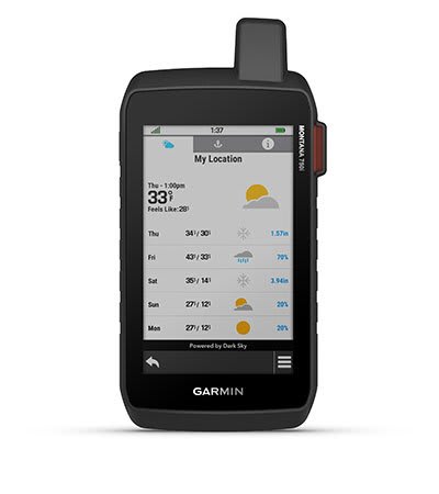
| ACTIVE WEATHER | Yes |
| Safety and Tracking features | |
| LIVETRACK | Yes |
| Outdoor Recreation | |
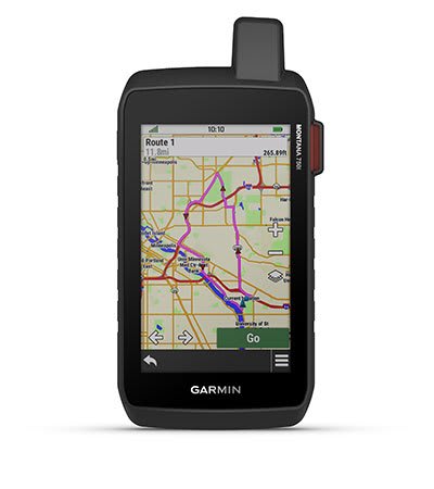
| POINT-TO-POINT NAVIGATION | Yes |
| AREA CALCULATION | Yes |
| HUNT/FISH CALENDAR | Yes |
| SUN AND MOON INFORMATION | Yes |
| XERO™ LOCATIONS | Yes |
| GEOCACHING-FRIENDLY | yes (Geocache Live) |
| CUSTOM MAPS COMPATIBLE | yes (500 custom map tiles) |
| PICTURE VIEWER | Yes |
| INREACH REMOTE WIDGET | Yes |
| LED BEACON FLASHLIGHT | Yes |
| inReach® Features | |
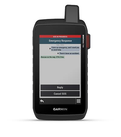
| INTERACTIVE SOS | Yes |
| SEND AND RECEIVE TEXT MESSAGES TO SMS AND EMAIL | Yes |
| SEND AND RECEIVE TEXT MESSAGES TO OTHER INREACH DEVICE | Yes |
| EXCHANGE LOCATIONS WITH OTHER INREACH DEVICE | Yes |
| MAPSHARE COMPATIBLE WITH TRACKING | Yes |
| VIRTUAL KEYBOARD FOR CUSTOM MESSAGING | Yes |
| SEND WAYPOINTS TO MAPSHARE DURING TRIP | Yes |
| SEND ROUTE SELECTION TO MAPSHARE DURING TRIP | Yes |
| INREACH REMOTE COMPATIBLE | Yes |
| Outdoor Applications | |
| COMPATIBLE WITH GARMIN EXPLORE™ APP | Yes |
| GARMIN EXPLORE WEBSITE COMPATIBLE | Yes |
| DOG TRACKING | yes (when paired to compatible dog track system) |
| Connections | |
| CONNECTIONS WIRELESS CONECTIVITY | Yes (Wi-Fi®, BLUETOOTH®, ANT+®) |
IN THE BOX
What’s in the Box?
- Montana 750i
- Lithium-ion battery pack
- USB cable
- Documentation

Reviews
There are no reviews yet.